And the results are in….sort of
We know you’ve been waiting to hear about the results of the much ballyhooed Oakland Urban Paths/WOBO confab of stairway investigation. We’ve surveyed and photographed 90% of Oakland’s stairways and paths are coordinating with the City of Oakland staff to analyze the information that will inform a 5-year prioritized improvement plan for that stairs. Stay tuned for more information.
In the meantime, Oakland’s Urban Paths are waiting for you. Grab a Walk Oakland! map and set out on foot to enjoy Oakland’s prime climes, views, and people.
In 2010, we’ll be posting more information on stairway walks and related neighborhood history. In the meantime, check out some stories from our recent inventory efforts:
Thoughts from Districts 6 and 7
After becoming smitten with Oakland’s maze of stairs and paths and having traversed many of them, I was a bit nonplussed about conducting an inventory of the stairways and paths of Oakland’s City Council Districts 6 and 7. For one thing, I knew the Walk Oakland! map did not show many of them in the area, so I figured that my effort may be short-lived. Secondly, the distance between the area and my residence did require some driving, but nothing that the prospect of new stairs would deter me from.
The highlights:
The Eastmont Hills Hop
Walking to the end of Seneca
The Short Cut… No Longer
Small Houses Above Mills College
Other Thoughts
The Eastmont Hills Hop
Leading a volunteer crew up and down the Eastmont Hills along mostly unpaved and overgrown pathways was an excellent exploration:

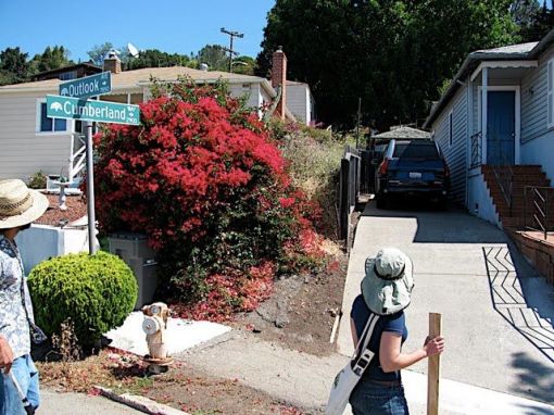
We trekked around the hilly streets in search of paths,

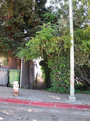
marveled at the street way convergence at the entry way of the King Estates Open Space,

and met neighbors with plenty to say about the stairs. Some were ecstatic to learn how many paths existed in the area and others shared that they used the paths during the summer, but not during the wet months as the unfinished paths turn into a muddy mess. Others wanted us to get away as quickly as we could and still others told us that they wished the City would close the paths adjacent to their homes, as they have fostered illicit activity and an entry way for potential burglars.

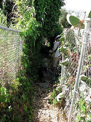
Undeterred, we were able to hack our way through densely overgrown paths…


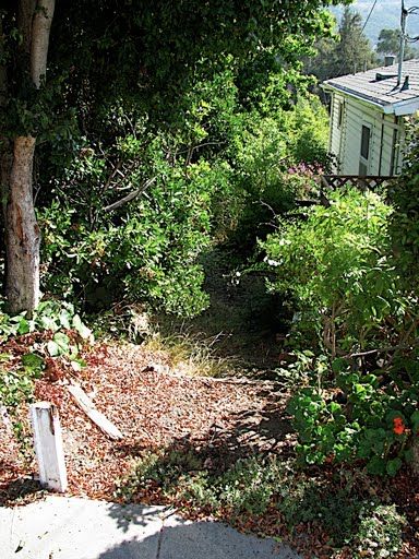
…and ponder the potential for vacant city-owned properties: urban agriculture, goat mowing anyone?
(back to top)
Walking to the end of Seneca
Across the street from Castlemont High School, a complex stairway climbs and traverses a ravine above MacArthur Blvd. to Seneca Street:


Seneca Street lies along a ridgeline above the densely vegetated riparian zone of Arroyo Viejo Creek to the east. Walking to the end of Seneca to find Stairway #153, I was excited to encounter another EBMUD reservoir:

The Seneca Reservoir is fenced. The large property made me think of efforts by water agencies across the country and throughout the Bay Area that are opening some of their previously restricted lands for recreational purposes. Could this chunk serve as a connection in the larger East Bay outdoor-by-foot puzzle?
Path #153 was another exploring opportunity that required some ducking and dropped us out onto the convergence of Burr and Lawlor streets via a wood stairway where we took in a view across the Oakland expanse:


(back to top)
The Short Cut… No Longer
As Oakland Urban Paths moves forward, we’d like to see these unique pedestrian resources included and labeled on Google Maps. Many of Berkeley’s stairways and paths are already included on the maps and I’m not sure if this is due to the diligence of our beloved brethren to the north (the Berkeley Path Wanderers Association), a pro-stairway google cartographer or otherwise. Regardless, I’ve been surprised that many of the prominent stairways and paths in Oakland are nowhere to be found on Google Maps.
Imagine my excitement then, to find the Short Cut (AKA path #78) clearly labeled on Google Maps:

My interest in the path grew as I approached it and all looked good upon first glance, but a few steps into the Short Cut, I noticed a red fence barrier. Peaking through the fence, I could see the path continuing on through the neighbor’s yard:


A peak around on Majestic Ave. where the Short Cut used to punch through left me scratching my head. Privatized paths are not uncommon, for whatever reasons: overuse, under-use, the Oakland/Berkeley Hills ’91 Fire or an overly ambitious DIY homeowner, some paths have been taken out of the public realm.
(back to top)
Small Houses Above Mills College
Oakland has houses large and small and traveling The Town via Oakland’s urban paths provides an unrivaled introduction to the various architectural styles we enjoy here:


Path #120 is identified on the Walk Oakland! map, running between Wyman St. and MacArthur Blvd., above the western end of the Mills College campus. The City no longer maintains the path…

…and a recently completed housing development project on MacArthur Blvd. has blocked off that end of the pathway.

Being able to check out these small homes and their proudly placed garages provided some relief to the otherwise sad site of another path taken out of use.
(back to top)
Other Thoughts
To be expanded on later …
(back to top)


